Friday, January 26, 2018

Salt Marsh Scrub At Sandy Hook NJ

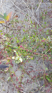
The salt marsh scrub along the bay side of Sandy Hook occurs in tidal and higher, irregularly flooded habitats. This blog identifies some of these moderately halophilic plants, including a few salt bushes (not grasses or trees in this post) from photos taken at Horseshoe Cove and Plum Island.

These pictures – and over 6 million observations worldwide - have been geolocated and posted at iNaturalist.org. You can zoom-in to Horseshoe Cove to see a map of icons representing groups of species, like plants, birds, fish, shells, etc.

The plant names in this post are linked to a great website for identifying plants in maritime habitats like Sandy Hook, “Cape May Plants – An Identification Guide” by CapeMayWildlife.  NY-NJ-CT Botany Online has biota lists for many of the parks in our area, including a plant list for Sandy Hook.

Common names vary, so use the Latin scientific name if you want to Google more images.


Horseshoe Cove

After leaving the path from the salt marsh bridge, walk north towards Battery Arrowsmith along the wetlands above the beach.

Sea Lavender (Limonium carolinianum)


The left picture shows the typical lavender-colored mature plant at the top, and the leafy sprout at the bottom, covered with some type of white powdery-mildew, that is a common Limonium pest. The picture on the right is what it looks like before it turns lavender. A lot of these lavenders bloom around the boardwalk at Spermaceti Cove.

Sea Blight (Suaeda maritima)


Look for both succulent spikelets and seed-like balls along the stems (it looks a little like spiky ragweed). The technical names for these parts may be in this link, along with a nice close-up. Suaeda is Arabic for black salt, which is the color of its extracted salt after drying (same link). Sea Blight is a lallation issue for Sea Bright.

Pickleweed (Salicornia sp.)


"Fetches more than $5 a pound at the Berkeley Bowl grocery.” Local species include Virginia Glasswort and Common Glasswort. Lots by Spermaceti boardwalk.

Marsh Elder (Iva frutescens)


After you cross the road from the Horseshoe Cove parking lot, look on the right (to the north) for an opening in the brush. You will see three distinct zones in the salt marsh that is caused by the frequency and duration of tidal flooding. Marsh Elder is the hedge in between two grasses: Saltmarsh Cordgrass (Spartina alterniflora), which is most adapted to living in saline water, and Saltmeadow Hay (Spartina patens), at the edge of the semidiurnal flooding, just below the treeline. The treeline is where a lens of freshwater (from rain) floats on the saline groundwater and the maritime forest begins.

Plum Island

Besides these plants, Plum Island also has three salt bushes. Salt bushes thrive in salt marshes because they secrete excess salt to maintain their internal salt balance (they are also well adapted to deserts). All three species are listed by NY-NJ-CT Botany Online for Sandy Hook.

Crested Orache (Atriplex mucronata)


Along the main path across from Parking Lot B, as it curves along the tidal cove to the north (on the right). Below a long hedge of Marsh Elder. The picture on the right shows the flower spike and the distinctive “spiky fruiting bodies”.

Spear-leaved Orache (Atriplex prostrata)


Along the main path across from Parking Lot B, well past where it curves along the tidal cove to the south (on the left). Note the triangular leaves.

Fivehorn smotherweed (Bassia hyssopifolia)


Same area as Atriplex mucronata, as well as further to the northwest along the path. The picture on the right shows the 5 horns.

These plants can be found at other locations in Sandy Hook, as well as in some towns along the Bayshore that still have intact salt marsh habitat. Log into iNaturalist and zoom in for exact locations.


Tuesday, January 2, 2018

Are Any Organizations Tracking Transparency Problems with the LSRP Program for the Murphy Transition?

The NJ Licensed Site Remediation Program (LSRP) was initiated in 2009 under Governor Corzine but fully implemented in 2012 under Christie. A concern has been that privatizing environmental cleanups would exempt records from OPRA, since those records are being maintained by the private sector rather than the NJDEP. This is discussed here, here, and here.

In 2012, the NJDEP published a convoluted policy to band-aid this problem “
NJDEP Site Remediation Public Inquiry Policy Document October 2012”.

How well is this working? I recently spoke with someone who was trying to get some information about a groundwater plume and was told by the NJDEP they didn't track that anymore. They told him to call the LSRP, who initially told him he would have to wait a year and a half for a final report. After much angst (including plowing through the NJDEP's complicated online search program, Dataminer), he resolved it by eventually finding out (on his own, not from the DEP or the LSRP) that his problem fell into the category "substantial public interest" in Section VI on page 4 of the DEP inquiry policy. When he announced to the DEP and LSRP that he was going that route (getting 25 signatures for a petition) the LSRP gave him "additional outreach" – i.e., he started answering his questions.

My take-home message from all this was wow, what a waste of time just to get to “reasonable”. I Googled "substantial public interest" and found only one other example of someone initiating this: a letter from the Kingswood EC in Hunterdon County on April 7, 2017 petitioning the DEP to assist getting more outreach from the LSRP for a salt plume as per NJAC 7:26 C-1.7(o) 
http://www.nj.gov/dep/srp/community/sites/hunterdon/active/petition_for_public_interest.pdf .

Perhaps the transparency problem I am describing is not common, and the system is mostly working well for the public (is the LSRP privatization really New Jersey’s quiet environmental accomplishment, or not?).

However, while the Kingswood letter and the policy are posted on the NJDEP's “Community Relations Site Lists” page, it is way too buried for a member of the public to easily become aware of their rights and options for getting information or updates about local contaminant plumes. This kind of transparency is less like public access and more like a data dump.


At a minimum, DEP staffers should be directing the public to their inquiry policy, not just telling them to call the LSRP, and the policy should be prominently published on the NJDEP website. County and Local government should be educated about this as well so they can competently answer questions from the public.


If this problem turns out to be common, it might justify funding:
... an electronic submittal system similar to the one utilized in Massachusetts. New Jersey's LSRP program is very similar to, and was in fact modeled after, Massachusetts' successful Licensed Site Professional (LSP) program. Recognizing the need for transparency, the Massachusetts DEP (MassDEP) set up an online filing system known as eDEP, which allows LSPs to upload submittals electronically and makes the information publicly available through a searchable database. MassDEP also scanned all the prior reports into PDFs and made them available online. By comparison, LSRPs submit forms (and, on occasion, reports) to the NJDEP in hard copy, which is stored in the NJDEP's central file along with any pre-LSRP reports, and are available for review only upon written request (and payment of related fees).”

Dataminer will need a major overhaul not just a tweak to make this work. Now, if you just want to review the work of a particular LSRP, you:


  • Click “Search by Category”
  • Select Site Remediation as the “Report Category”.
  • You are on the Site Remediation Report page. Half way down is “LICENSED SITE REMEDIATION PROFESSIONAL INFORMATION”.
  • Click on “Licensed Site Remediation Professional List”. It's alphabetical, so you can page through 29 links, or export it to a pdf or Excel spreadsheet. When you find their name, write down their License Number.
  • Go back to the Site Remediation Report page. Scroll down to “LICENSED SITE REMEDIATION PROFESSIONAL INFORMATION”. Click on “License Site Remediation Professional Comprehensive Report” and enter the LSRP number.
Good luck with the Acronyms etc once you get there. I have written about how hard it is to use Dataminer to dig up information about discharges from Combined Sewer Outfalls in a previous blog.