Thursday, September 1, 2016

Minecraft-worthy Geology In The Wrack Line At Sandy Hook, NJ – Part 5 of 5: Coal and Tarballs

                                                          Coal; Jetty rock w oil

Coal

Chunks of coal, as well as slag from burned coal and smelted iron, are found in the bay and ocean wrack lines at Sandy Hook.

Coal had been an important source of heat in public buildings and power plants until the late 1960’s. Most of the coal washing up on the beach came from spillage from ships, or from dumped “cellar ash”. Some of it may be from “sea coal” carried along the coast from rivers in the Appalachian coal fields and from the Valley and Ridge province long before it was mined. It was abundant enough on Long Island beaches that a permit was issued in 1677 to locate significant deposits.

With 
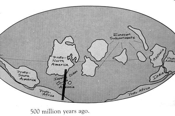
more pressure, heat and time, peat transforms into lignite, bituminous, and eventually, anthracite coal. Most coal was formed in peat or coal swamp forests (scroll down to The Coal Age) about 300 million years ago during the Carboniferous Period:

Coal forms from the accumulation of plant debris, usually in a swamp environment. When a plant dies and falls into the swamp, the standing water of the swamp protects it from decay. Swamp waters are usually deficient in oxygen, which would react with the plant debris and cause it to decay. This lack of oxygen allows the plant debris to persist.” When this layer of peat is buried by sediments, the weight “compacts the plant debris and aids in its transformation into coal. About ten feet of plant debris will compact into just one foot of coal.”

Some chunks may also be lignite deposits from the Raritan-Magothy Formation where it outcrops along Raritan Bay in Middlesex County. Recently formed peat from tidal flats and salt marshes can also be seen in the wrack line after storms, and cedar peat deposits have been found in cores of the seafloor a few hundred feet off coastal lakes in Monmouth County. Here are more pictures of peat, lignite and coal; scroll down for a picture of peat with clam borings found on a beach in Long Island.

Tarballs

While most coal was formed from peat swamps about 300 million years ago, oil and natural gas were formed from plankton, most of it from 252 to 66 million years ago.

Black round tarballs from oil spills from refineries along Raritan Bay and oil tankers can periodically be found in the wrack line at Sandy Hook. About 21 billion gallons oil transported by marine tankers passed under the Verrazano Bridge in 2010, as reported in “A Stronger, More Resilient New York” (p134, pdf-p 4).

Scientists from the University of Utah have calculated that it takes 98 tons of these buried prehistoric plants to produce a single gallon of gasoline. They also found that the amount of fossil fuel burned in one year is equivalent to "'all the plant matter that grows in the world in a year,'" including vast amounts of microscopic plant life in the oceans.”

Volcanoes were a major source of the carbon dioxide in the atmosphere during the period of geologic time known as “Greenhouse Earth”. A superplume caused by abundant volcanoes produced 4000 ppm of carbon dioxide and other greenhouse gases that melted the icecaps during the Cretaceous and put the NJ coastline between the Watchung Mountains and Rt 1 (scroll to Figure “Generalized geographic map of the United States in Late Cretaceous time”).

Currently, carbon dioxide produced by fossil fuels is about 130 times present volcanic emissions, but just one tenth of the catastrophic super-plume levels of the Cretaceous.

Widespread scientific consensus exists among scientists that are experts in the field of climate studies that the world’s climate is now changing (NASA) faster (NOAA) due to burning so much of these plant-derived fossil fuels.

The other four blogs are at http://pehealthnj.blogspot.com/ .


Minecraft-worthy Geology In The Wrack Line At Sandy Hook, NJ – Part 4 of 5: Jetty Rocks


T(l-r): Basalt/Diabase, Mica Schist, Gneiss
B(l-r): Limestone w Stromatolites, Pumice, Scoria 

Jetties are mostly volcanic rocks like basalt and diabase - not obsidian!

Obsidian is a sought-after block in Minecraft that forms when magma rapidly cools in air or water. There's no obsidian or volcanoes at Sandy Hook, but most of those dark gray boulders in the jetties were also formed by volcanoes (slide 20).

Like obsidian, diabase is formed from magma in the earth's crust, while basalt is formed from lava, which is magma that has flowed to the earths surface.

Basalt and diabase were formed as the supercontinent Pangaea started breaking apart, according to the theory of plate tectonics. The Appalachian Mountains and Anti-Atlas mountains that are now in Africa were once a single range higher than the Himalayas (Gallagher, 2003). NJ shared a border with Morocco about 245 million years ago!

When Pangaea started rifting apart about 200 million years ago, lava formed into the basalts of the Watchung Mountains, the pillow lava (Figure 94) of the Orange Mountains, and the Great Falls in Patterson). Diabase cooled into the columns of the Palisades. The water surrounding Pangaea rushed in to fill the rift between the new continents, creating the Atlantic Ocean (Gallagher, 2003). A lot going on in the back-story of those bland jetty rocks and the gravel in your driveway.

Basalt and diabase are also used as traprock and gravel are mined in the Piedmont province of NJ. Chunks of the jetties worn smooth as sea glass can be found in the wrack line.

Other Jetty Rocks

Schist and gneiss boulders like those found in the Highlands province of NJ can be found in jetties at Sandy Hook or in the seawall extending to Sea Bright that was built by the Army in 1898 (scroll down for rock pictures). Several boulders of light gray mica schist can be seen among the darker basalts in the jetty protecting the road along Horseshoe Cove south of Parking Lot K. When pieces are found in the wrack line they look like this.

Parts of the granite seawalls the Army built around the tip of Sandy Hook in the 1890s to protect the gun batteries still line the shoreline of the freshwater pond past Nine Gun Battery near North Beach. Granite in NJ is from the Highlands province (map, p. 1)

Limestone boulders that could be half a billion years old from the Valley and Ridge province (start at slide 37) are also in the seawall near the entrance to Sandy Hook. The chalky white boulders that formed from shells accumulating in warm shallow seas stick out among the dark, volcanic basalts in the seawall near the steps from the Highlands Bridge. Some have banded swirls that may be fossils of stromatolites - the Earth's oldest fossil (3.7 billion years old) - that gradually changed the “atmosphere from a carbon dioxide-rich mixture to the present-day oxygen-rich atmosphere” 2.5 billion years ago.

Other Volcanic Rocks

Other volcanic rocks in the wrack line more likely washed up from a storm-flooded landscaping project rather than from drifting in on the Gulf Stream from a Caribbean volcano. Pumice (scroll down for picture) looks like quartz but is much lighter, almost airy; when you break it open you can see crystals similar to obsidian. The unusual foamy look comes from being rapidly cooled and depressurized after it is ejected from a volcano. Scoria forms from cinder cones around volcanoes and is used to make lightweight concrete.

Bedrock

The gneiss and schist like the boulders found in the jetties and seawall make up the bedrock (pdf-p 21) beneath the aquifers of the coastal plain in NJ. They are metamorphic rocks formed from shale and sandstone and are found in the Highlands province of NJ. (The Wanaque Tonalite Gneiss is part of an outcrop that runs from Wanaque to Ringwood with the oldest rocks in NJ - 1.35 billion to 1.37 billion years old.

In Monmouth County, this “basement rock” lies about 700 feet below sea level, beneath the deepest aquifer in Sandy Hook, the Potomac-Raritan-Magothy (map). Bedrock is more than 1500 feet below sea level in Manasquan, and over a mile deep in Cape May (map on pdf-p 19 ).

Selected References

Forman, Richard (Ed.). 1998. Pine Barrens: Ecosystem and Landscape


The other four parts of this blog are at http://pehealthnj.blogspot.com/ .

Minecraft-worthy Geology In The Wrack Line At Sandy Hook, NJ – Part 3 of 5: Iron, Sandstone and Quartz


T(l-r): Peanut Stone, Sandstone, Iron slag 
B(l-r): Gardeners Clay, Quartz

Peanut Stone: Iron-Cemented Sandstone and Quartz

Sandstone, iron, and quartz are all found in a local sandstone that looks like chunks of peanut brittle in the wrack line.

“Peanut stone” is a quartz-studded ironstone of limonite formed 11-9 million years ago (slide 3) during the Tertiary period.

It is part of the Cohansey sand formation near the top of the Mount Pleasant Hills across the bay From Sandy Hook (the Cohansey sands extends south through the Pine Barrens and becomes the largest water-table aquifer in NJ).

The peanut stone is the caprock of the ridgeline that has prevented the Mount Pleasant Hills from washing away to flatlands like most of the Bayshore. At 266 feet, Mount Mitchell in Atlantic Highlands is the highest point south of Maine directly on the coastline. During the last Ice Age (the Pleistocene Epoch) this ridgeline may have been “... as high as 600 feet above (ancient) sea level ...”.

Locals have been using peanut stone since the 1880's to build chimneys, walls, the Dempsey house in Leonardo, the Stone Church in Locust, and the stone bridge over Grand Avenue in Atlantic Highlands.

Ironstone used to be mined and smelted in Monmouth County for its iron ore. “European settlers mined bog iron in local streams” for its iron ore “to produce utensils, such as plows and axes, and cannon balls for the American Revolution.” Ubiquitous and slimy iron bacteria produce a floc in streams and seeps in Monmouth that resembles Acid Mine Drainage, and an iridescent rainbow sheen that mimics oil spills.

The first iron works in NJ was constructed around 1674 in Tinton Falls. The industry peaked after
the war of 1812 until about 1844, when transporting coal and richer ores of iron from
Pennsylvania became more cost-effective (Forman, 1998).

Chunks of iron slag from iron smelting are scattered like small meteroites in the bay and ocean wrack lines at Sandy Hook.

Much of the other sandstone and clay concretions washing up on the beach are from Sandy Hook . The surface of Sandy Hook is very young, only about 3-4000 years old (see Holocene Deposits), but it rests on sediments that are more than 250 feet deep. They may have began accumulating after the peak of the last Ice Age 25,000 years ago, when the Atlantic coastline almost reached the Hudson Canyon, about 100 miles offshore today.

They are also from submerged barrier beaches that developed from 12,000 to 7,000 years ago when sea level was lower (see Holocene Deposits). Small shells and other “neofossils" can often be observed in “chunks of well cemented beach sand, displaying bioturbation and marine fossils, [that] are eroding from these submerged barriers”, that are as near as a few hundred feet offshore.

The oddly molded chunks of Gardeners Clay (Figure 148A) that washes up on the ocean beaches after storms has been found in sediment cores at Sandy Hook near Spermaceti Cove (pps. 29-31) as well as beneath Long Island. Gardeners Clay is a glauconitic, foraminiferal marl and sand that was formed in an ancient bays.

Quartz

The peanuts in peanut stone are quartz, which is the most common pebble found on the beach.

Quartz is the second most abundant mineral on earth (after feldspar), and is found throughout NJ in igneous rocks like granite, sedimentary rocks like sandstone, and metamorphic rocks like schist and gneiss.

Sand is made of fragments of rocks and minerals including quartz. Quartz can be found in all four provinces in NJ, but originally eroded from the Appalachian Mountains (p. 142). The Beacon Hill Gravel that formed 9-7 million years ago at the top of the Mount Pleasant Hills has been called “essentially the same” as the “modern gravel deposits on Sandy Hook”.

The different colors in quartz are caused by the chemicals present while it is crystallizing from molten magma. Colors include citrine, rose quartz, amethyst, smoky quartz, and milky quartz. The rust-stain common in the quartz pebbles in the wrack line is from the iron in the soil or groundwater.

Selected References

Forman, Richard (Ed.). 1998. Pine Barrens: Ecosystem and Landscape

The other four parts of this blog are at http://pehealthnj.blogspot.com/ .


Minecraft-worthy Geology In The Wrack Line At Sandy Hook, NJ – Part 2 of 5: Glauconite


On the beach, glauconite looks like pale green quartz but feels noticeably lighter.

It's nicknamed the “drinking water stone” at Sandy Hook because water entertainingly disappears into its pores.

It is a mineral found throughout Monmouth County and other parts of the Coastal Plain province in clay, silt and sand - not the lithified, stony formation on the beach.

Depending on its acid and clay content, it is nicknamed greensand, marl, poison marl, rotten stone, or hardpan.

It is actually a green to black silicate of iron, potassium, and phosphorous that formed millions of years ago from the droppings of sediment-dwelling invertebrates in the shallow shelf regions of Cretaceous and Tertiary seas. Its potassium content made glauconite a widely used as a soil conditioner in Monmouth County after Peter Schenck started using it on his farm in 1768 near aptly named Marlboro (Forman, 1998).

Glauconite makes up much of the Navesink Formation at the base of the Mount Pleasant Hills, a ridgeline (and major watershed divide) that begins in Hartshorne Park in Middletown by Sandy Hook Bay, and crosses NJ all the way to Delaware Bay in Salem County.

The glauconitic clay in the Navesink and other formations near the bottom of the Mount Pleasant Hills occasionally interact with the overlying sands to produce landslides or “slump blocks” in Atlantic Highlands and Highlands (p. 22). Sometimes when heavy rainfall rapidly percolates through the sand at the top of the hill, water builds up on the impervious glauconitic clay until the heavy, saturated block of sand - and anything on it - slides over the marl and down the hill (pictures, pps. 14-21).

The Navesink Formation was formed about 70 million years ago when Sandy Hook was beneath more than 150 feet of shelf water. The carbon dioxide and other greenhouse gases that helped melt the icecaps (and set up the dinosaurs for extinction) during the Cretaceous period were from a superplume caused by abundant volcanoes.

Back then, the Atlantic coastline was between the Watchung Mountains and Rt. 1; scroll to the map “Generalized geographic map of the United States in Late Cretaceous time”. (Rt. 1 in NJ more or less follows the geologic boundary between the the rocks of the Piedmont province and the sandy outwash of the Coastal Plain known as the Fall Line.)

The first dinosaur discovered in North America, the duck-billed dinosaur, Hadrosaurus foulkii – our state dinosaur - was discovered in 1858 as a result of marl-mining at a farm near Haddonfield, NJ. (Forman, 1998).

About 20 miles southwest of Sandy Hook, a black marl outcrop of the Navesink Formation (picture, p. 11) towers over Big Brook in Colts Neck, where fossil enthusiasts can shell-pick 70 million-year-old oyster shells and other marine species right from the streambed.

Greensand is one of the oldest types of water treatment used to remove heavy metals from drinking water, including radium, and is used medically to speed up the elimination of internal radionuclides (Table III, p. 9).

Selected References

Forman, Richard (Ed.). 1998. Pine Barrens: Ecosystem and Landscape

The other four parts of this blog are at http://pehealthnj.blogspot.com/ .


Minecraft-worthy Geology In The Wrack Line At Sandy Hook, NJ – Part 1 of 5

Now I get it. Those busloads of school kids looking for, of all things, obsidian, as well as shells at Sandy Hook are what the New York Times is calling the Minecraft Generation.

Minecraft is a video game released in 2009 that allows players to build things out textured cubes in a 3D generated world that is now the second best-selling video game in the world.

But its not just virtual Lego. It's now commonly used in schools to “increase kids’ interest in the “STEM” disciplines — science, technology, engineering and math”. Its fans are awaiting a new “Minecraft: Education Edition” that will be released this fall.

One of the sciences children learn about in Minecraft is geology - so effectively that the governments of Sweden, England and Scotland have developed programs that allow players to use local geology while they are playing Minecraft.

There is plenty of Minecraft-worthy geology at Sandy Hook too. You can walk along its ocean and bay beaches and see rocks from all four geological provinces in NJ. The next four parts of this blog will help you prepare for your #deeptime #geowalk – along a timeline from a few thousand to over half a billion years old.

Part 2: Glauconite


Part 3: Iron, Sandstone and Quartz


Part 4: Basalt and Diabase, Schist, Gneiss, Granite, Limestone, Pumice, and Scoria


Part 5: Coal and Tarballs


The other four parts of this blog are at http://pehealthnj.blogspot.com/ .


Friday, July 22, 2016

Half a Billion Years Ago in (Proto) Staten Island

The next time you are enjoying the spectacular views of Manhattan from the North Beach at Sandy Hook, NJ, shift your gaze across the Verrazano Bridge to Staten Island. The crest of that bland, dark ridgeline is Todt Hill. Todt is Dutch for “dead”.

At 410 feet, it is the highest natural point on the eastern seaboard south of Maine. The Dutch settlers probably called it “Dead Hill” because of its rocky, treeless outcrops. One of the bedrock exposures is serpentinite: grayish-green, about 430 million years old, and consisting mainly of the mineral serpentine. It contains such high levels of magnesium that plants can't grow in its thin soils.

That was then. Today, Todt Hill is a verdant, upscale community, that was once home to Paul Castellano of the Gambino crime family.

An average sample of this serpentinite also contains about 27% chrysotile asbestos. In 1858, the H.W. Johns Manufacturing Company began mining chrysotile asbestos in Staten Island for manufacturing fire-resistant shingles (Powell, 2005). They eventually merged with Johns-Manville, which went on to manufacture a variety of asbestos-containing products in numerous factories, including one in Manville, NJ. It was litigated into bankruptcy in 1982, by “class action lawsuits based on asbestos-related injuries such as asbestosis, lung cancer and malignant mesothelioma.”

The west coast has outcrops of serpentinite as well, but the serpentine in the San Andreas Fault is about 400 million years younger than in Staten Island. The University of California has published a factsheet about how to recognize and reduce risks from the asbestos in its landscape.

That's all well and good but how the hell did it get there?

0.5 bya

Half a billion years ago, North America was a continental land mass near the equator called Laurentia. It was across the Iapetus Ocean (an early version of the Atlantic Ocean) from Gondwana - the ancient continent of Africa, South America, Australia, Antarctica, and India (Benimoff and Ohan, 2005), according to the theory of plate tectonics. The plates containing these continents were converging and would eventually form the single supercontinent of Pangaea about 200 million years later.

Converging means colliding. About 470 million years ago, as the Iapetus Ocean was closing during the slow-motion collision of Laurentia and Gondwana, a string of volcanic islands in between the two continents (map) called the Taconic Arc collided with Laurentia (Powell, 2005).

As the ocean floor between Laurentia and the islands was driven under Laurentia (subduction), a “slice”of it buckled onto the continent. This fragment was composed of peridotite, which over time “metamorphosed to form the string of serpentinite pods that occur across the New York City area, including the Staten Island serpentinite” (Powell, 2005).

It's the oldest rock on Staten Island. NJ's serpentine deposits are discussed on page 5 of this 2014 NJGS newsletter.

Cameron's Line

Not only is the Taconic Orogeny the source of this asbestos, as well as the first of three mountain -building events that eventually formed the Appalachian mountains, it created a crack in the earth's crust - a fault - called Cameron's Line.

Cameron’s Line is an 80 to 180 foot wide band of crushed rock originating in New England that lies about 600’ below NY Harbor. It crosses the Bronx, follows the East River, and passes under Staten Island to the west of Todt Hill. This map (pdf-p 2, Figure 1) shows it (CL) entering NJ's Coastal Plain in Middlesex County by western Raritan Bay. This is near the Fall Line - the geologic boundary between the the rocks of the Piedmont and sandy outwash of the Atlantic Coastal Plain – that more or less follows Rt 1 in NJ.

NJ's Coastal Plain is deposited on a bedrock of gneiss and schist in Monmouth County (pdf-p 21) – metamorphic rocks formed from shale and sandstone – and other rock (pdf-p 12). In Monmouth County, this “basement rock” slopes steeply under the deepest aquifer in the County, the Potomac-Raritan-Magothy aquifer system (map). The basement rock is about 500 feet below sea level in Aberdeen, and more than 1500 feet BSL in Manasquan – and over a mile in Cape May (map on pdf-p 19 ).

Cameron's Line cuts through the basement rock beneath the northern Coastal Plain and may eventually join with the Huntingdon Valley Fault zone (HVF on the map in Figure 1) near Philadelphia and Trenton (pdf-p 17).

Earthquakes in NJ are mostly caused by the Ramapo Fault along the Ramapo mountains, as well as Cameron’s Line. The Ramapo Fault is about twice as old as Cameron's Line, and at 1 billion years is one of the oldest faults in the US. This is one of the reasons the earthquakes on the East Coast are less active than on the West Coast - because the geology of the East Coast is so much older. The crust on the East Coast is also cooler and more rigid than on the West Coast, so seismic waves disperse further and earthquakes are not as intense locally.

The New Jersey Department of Environmental Protection's webpage on the Earthquake Risk in New Jersey, states that “the presence or absence of mapped faults (fault lines) does not denote either a seismic hazard or the lack of one ...”

Okay. In any case, what's beneath those rolling hills in Staten Island is anything but bland. Or as Job said: “As for the earth, out of it cometh bread: and under it is turned up as it were fire.”


Selected References (no longer posted)

Benimoff, A. and Ohan, A. Accessed 12/23/05. The Geology of Staten Island. Formerly posted at www.library.csi.cuny.edu/dept/as/geo/sigeo.htm

Powell, Wayne. Accessed 12/23/05. The Staten Island Serpentinite. Formerly posted at http://academic.brooklyn.cuny.edu/geology/powell/NYCgeology/staten%20island/staten_island.htm


Monday, June 6, 2016

A Dead Zone Almost Half As Big As NJ Formed Offshore 40 Years Ago

Climate scientists are studying three major changes to the ocean caused by climate change: warming, acidification, and deoxygenation. Both low oxygen and acidity are expected to worsen as ocean temperatures rise, especially in areas that already have a history of naturally low oxygen levels.


NJ learned that 40 years ago.

1976

June is the 40th anniversary of the first reports by divers off Sandy Hook of a floc-covered seafloor of dead or dying fish and shellfish. By the 4th of July, sulfide-blackened bottom waters had expanded southward about 12 miles off Manasquan (Mahoney, 1979; Walsh, 1979).

By the time the Bicentennial summer had passed, 3300 square miles of bottom waters - 60 feet to 37 miles offshore, from Sandy Hook to Cape May – had become hypoxic (low-oxygen) or anoxic (no oxygen) (Sindermann et al., 1979).


Cooler temperatures and vertical mixing of the water column finally put oxygen back into the bottom waters by October. But the commercial fishing industry has lost more than $430 million in surf clams, bluefish, tuna, fluke, sea bass, and lobster. It was declared a resource disaster area by the Federal government, and is still the worst marine die-off in the state’s recorded history (Sinderman et al., 1979; Walsh, 1979).

Not Pollution

While the die-off happened near the highly-polluted Hudson-Raritan Estuary, as well as the sludge and spoils dumpsites that existed offshore in 1976, there jut wasn't enough nutrients from these sources to account for the scale of the event (Swanson et al., 1979).

Instead, it was the way weather and ocean currents came together that year to create an anomalous, massive event - a "perfect storm”, like Superstorm Sandy, but below the ocean surface.

Since it was much warmer than usual during February and March, the ocean surface began warming earlier than normal. As the lighter, less dense water at the surface warmed faster than at the bottom, the water column stratified and formed a barrier that isolated surface water from bottom water (Chant et al., 2004a). Salinity (halocline), temperature (thermocline),and density (pycnocline) stratifications developed earlier than usual (Sinderman et al., 1979; Swanson et al., 1979). The cooler, denser, and less oxygenated bottom layer separated from the ocean surface – a few months earlier than normal.

This meant the trapped oxygen had to last a few months longer. Secondly, river run off began two months earlier and this led to more nutrients being deposited into the bay. On top of all of this, there was significantly less storm action that spring and summer. Usually the storms break up algae blooms and mix up the water column bringing oxygen to the deeper water layers. All of this meant the oxygen in the ocean depths had to last the marine life two additional months.”

Winds and Currents

Most significantly, southerly winds began in late winter rather than in April, and southwest winds persisted for 4-6 weeks through May and June (Malone et al., 1979; Sinderman et al., 1979; Swanson et al., 1979). Not only did the wind create a stronger thermocline separating the surface and bottom water - it concentrated a massive bloom of the dinoflagellate Ceratium tripos in the isolated bottom waters.

C. tripos is normally an insignificant species of algae found offshore in cold, dark water, where its numbers are kept in check by grazing copepods (Malone et al., 1979; Sinderman et al., 1979; Swanson et al., 1979). But that year the southwesterly winds moved it into the sealed-off bottom waters, where it accumulated from February until July (Malone et al., 1979; Sinderman et al., 1979; Swanson et al., 1979).

The persistent southwesterly winds also slowed, then reversed. the normal southwestward (north to south) flow of bottom currents on the shelf (Sinderman et al.,. 1979; Walsh, 1979), massing the algae in stagnating currents, until the algae bloom finally used up all the available nutrients and oxygen (Malone et al., 1979; Sinderman et al., 1979; Swanson et al., 1979). Then the bloom crashed, using up even more oxygen as it decomposed - initially from Sandy Hook to Manasquan, then expanding towards Atlantic City (Mahoney, 1979). The dead algae was the ubiquitous floc the divers had seen.


As the decomposing bloom rapidly used up all the remaining oxygen, sulfate – the oxygenated form of sulfur in seawater - was reduced to the form without oxygen - hydrogen sulfide. H2S is a gas that smells like rotten eggs and turns water and mud black. It is lethal to marine life, especially benthic (sediment dwelling) organisms – like surf clams, hard shell clams (quahogs), lobsters, and sea scallops. They are literally stuck in the mud – and couldn't flee like most of the finfish did. Some of the territorial fish, such as the eel-like ocean pout, died hiding in the rocks (Reid, 2006; Sinderman et al., 1979; Swanson et al., 1979).

Upwellings

The low oxygen event in 1976 happened in part due to a strong, early upwelling. Winds normally predominate from the south during the summer in NJ and form a nearshore current at the surface that flows to the north. This creates the littoral drift that deposits sand on the southern side of jetties in Monmouth, and is why we have a barrier beach like Sandy Hook. When southwest winds persist for several days, cold, higher-saline bottom water flows towards the shoreline as warmer, lighter water is disperses offshore. Upwellings are why sometimes on a blazing hot day at the beach the water is too cold to go swimming.

There are nice graphics of upwellings at the Rutgers Center for Ocean Observing Leadership (the COOL Room) here and here. In 2015, @Rutgers_Cool tweeted the first upwelling of the year on May 26th. No upwelling tweet so far this year because of our cooler El Nino spring.

Staying Tuned

In 2011, Rutgers tracked chlorophyll levels in an offshore algae bloom of Nannochloris that became huge enough to make the news and be called “the blob”. This was also caused by an upwelling, and stretched from Sandy Hook to Cape May, but was broken up by Hurricane Irene in August before it could grow large enough to lower oxygen levels.

Scientists at the Smithsonian Environmental Research Institute in Maryland have found that Atlantic Silversides (spearing) in Chesapeake Bay will die in oxygen concentrations that don't normally kill them when the water is also acidic. Silversides are the bottom of the marine food web in NJ as well. Anything that threatens their survival also threatens the survival of the larger predator fish that depend on them.

Rutgers' Department of Marine and Coastal Sciences uses marine gliders (Autonomous Underwater Vehicles) to map subsurface dissolved oxygen levels off the NJ coast, that has been supported by both the EPA and the NJDEP, Station JCTN4 (Buoy 126) at the Jacques Cousteau Reserve near Atlantic City measures dissolved oxygen in the Great Bay at the southern end of Barnegat Bay.

You can see which way coastal currents are moving, and lots of other information, whenever you like, at The New York Harbor Observing and Prediction System (NYHOPS) webpage, maintained by the Davidson Laboratory at Stevens Institute of Technology.

Selected References

Chant, R.; Glenn, S.; and Kohut, J. 2004. Flow reversal during upwelling conditions on the New Jersey inner shelf. Journal of Geophysical Research. Vol. 109, C12S03.

Figley, B., Carlson, J., Vaughan, D., and Hollings, S. Accessed 6/5/16. Ocean Fishkill/1976. NJScuba.net http://www.njscuba.net/biology/misc_water.php#FishKill


Malone, T., Esaias, W. and Falkowski, P. 1979. Chapter 9. Plankton dynamics and nutrient cycling. Part 1. Water column processes. In Oxygen Depletion and Associated Benthic Mortalities in the New York Bight, 1976. NOAA Professional Paper 11. Rockville Md. December.

Mahoney, J. 1979. Chapter 9. Plankton dynamics and nutrient cycling. Part 2. Bloom decomposition. In
Oxygen Depletion and Associated Benthic Mortalities in the New York Bight, 1976. NOAA Professional Paper 11. Rockville Md. December.

Rutgers Department of Marine and Coastal Sciences. Accessed 6/5/16. Discover New Jersey’s Dead Zone http://marine.rutgers.edu/~sage/BeanCreative/Unit1_Plume/4 Discover NJ Blooms.doc

Sindermann, C. and Swanson, L. 1979. Chapter 1. Historical and regional perspective. In Oxygen
Depletion and Associated Benthic Mortalities in the New York Bight, 1976. NOAA Professional Paper 11. Rockville Md. December.

Swanson, L., Sindermann, C. and Han, G. 1979. Oxygen depletion and the future: an evaluation. In Oxygen Depletion and Associated Benthic Mortalities in the New York Bight, 1976. NOAA Professional Paper 11. Rockville Md. December.

Reid, R. and Radosh, D. 1979. Benthic Macrofaunal Recovery After the 1976 Hypoxia off,New Jersey
U. S. Department of Commerce. National Oceanic and Atmospheric Administration. National Marine Fisheries Service. Northeast Fisheries Center. Sandy Hook Laboratory Highlands, New Jersey 07732 http://www.nefsc.noaa.gov/publications/series/shlr/shlr79-18.pdf

Walsh, J. 1979. Forward – Oxygen Depletion and Associated Benthic Mortalities in the New York Bight, 1976. NOAA Professional Paper 11. Rockville Md. December.